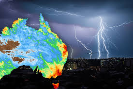
Meteorologists are warning of severe thunderstorms along Australia’s east coast, particularly near the border between New South Wales (NSW) and Queensland, as atmospheric conditions create a high risk of tornadoes and giant hailstorms.
Weather Conditions Favor Supercell Formation
The Bureau of Meteorology (BoM) has issued alerts citing strong winds, high humidity, and intense atmospheric instability, conditions favorable for the development of supercells — powerful storm systems capable of producing destructive hail, damaging winds, and tornadoes.
Residents in affected areas are being urged to stay indoors, secure loose objects, and monitor weather updates closely. Authorities also warned of potential flooding and power outages as heavy rainfall is expected to accompany the storms.
“Conditions are ripe for isolated but severe supercell thunderstorms,” said BoM meteorologist Claire Robinson. “While tornadoes are rare in this region, the combination of extreme wind shear and instability raises the possibility of localized tornadic activity alongside large hail.”
Emergency Services and Community Preparedness
Emergency services in both states are on high alert, with contingency plans in place for rapid response to storm damage. Local councils have advised schools, businesses, and communities to prepare for potential disruptions over the next 24–48 hours.
Advice for Residents
Experts emphasize that the storm system is fast-moving, and residents should avoid unnecessary travel. The BoM continues to monitor the situation and will update warnings as new data becomes available, emphasizing that vigilance is key to minimizing risks from severe weather.
Context of Volatile Weather
This marks another period of volatile weather conditions for Australia’s east coast, highlighting the increasing unpredictability of extreme storms in the region.

