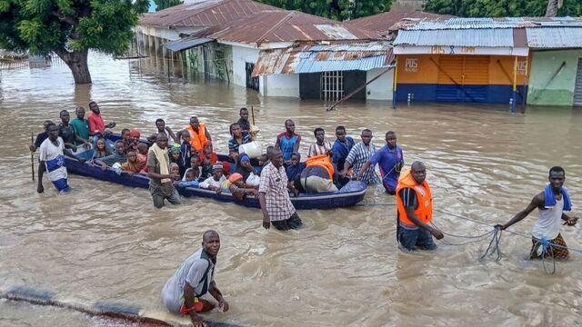
Large swathes of Central and Northern Africa are bracing for several days of heavy rainfall, with forecasters warning of potentially dangerous weather patterns capable of triggering floods, mudslides, and urban waterlogging. Between September 4 and 6, a tropical disturbance is expected to bring widespread downpours across multiple countries, accompanied by intense thunderstorms and strong winds.
The storm system is projected to affect a broad belt of the continent, stretching from western Ethiopia to northern Senegal. Areas at risk include northern Nigeria, southwestern Niger, eastern Burkina Faso, northern Côte d’Ivoire, Guinea, Sierra Leone, Liberia, southern Mali, and Mauritania. Rainfall totals are expected to reach 40 to 80 millimeters in many locations, with some localized regions forecast to receive 90 to 130 millimeters over the three-day period.
In addition to the heavy rain, severe convective weather is likely. Residents in the affected zones may experience short but intense bursts of rainfall, lightning, and strong gusts of wind. Such conditions often lead to flash floods and exacerbate soil instability in hilly or mountainous regions, raising the danger of landslides and mudslides. Urban areas are also particularly vulnerable, as drainage systems can quickly become overwhelmed, leading to waterlogging and disruption of daily life.
Communities across these regions are no strangers to the consequences of extreme rainfall. In recent years, West and Central Africa have witnessed a growing number of floods that have damaged homes, displaced families, and destroyed agricultural land. These disasters often strike with little warning, leaving vulnerable populations at heightened risk. Humanitarian agencies consistently warn that flooding not only causes immediate destruction but also creates long-term challenges, including waterborne diseases, food insecurity, and the loss of livelihoods.
In rural areas, saturated soils and swollen rivers heighten the threat to smallholder farmers who depend on stable weather for their crops. Already, unpredictable rainfall patterns linked to climate change have left millions facing challenges in sustaining food production. In urban centers such as Freetown, Monrovia, and Lagos, dense populations and fragile infrastructure increase the danger of widespread disruption when heavy rains fall in short, powerful bursts.
Authorities and emergency services in the affected countries are urged to remain vigilant, as the forecast indicates that conditions could deteriorate rapidly. Local populations are being advised to prepare for potential flooding, avoid crossing swollen rivers, and stay clear of landslide-prone slopes. Past events have shown that preparedness and early action can significantly reduce casualties and damage.
The heavy rains expected in the coming days serve as yet another reminder of Africa’s growing vulnerability to extreme weather events. Climate scientists have repeatedly warned that warming oceans and shifting atmospheric conditions are making storms more intense and rainfall more erratic. This adds to the challenge for nations already struggling with fragile infrastructure and limited disaster response resources.
As the tropical disturbance moves westward, the need for coordinated regional monitoring and rapid response becomes critical. With cumulative rainfall potentially exceeding 100 millimeters in localized areas, the risk of secondary disasters cannot be ignored. The coming days will test the resilience of communities across Central and Northern Africa, underscoring once again the urgent need for long-term climate adaptation and stronger disaster management systems.

