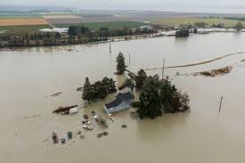
Meteorologists are warning of a potent atmospheric river impacting the Pacific Northwest starting today, with heavy rainfall and snow expected to continue into the weekend.
Rainfall and Flood Risk
Widespread rainfall totals are forecasted at 3–5 inches, with some localized areas potentially receiving higher amounts. Cities such as Portland, Medford, and Eureka are particularly at risk for flash flooding, river overflows, and hazardous travel conditions.
Snow in Mountainous Areas
Mountain regions are expected to receive significant snowfall, raising concerns about slippery roads, potential travel disruptions, and challenging driving conditions. Authorities urge motorists to exercise caution and limit travel where possible.
Precautionary Measures
State and local agencies advise residents to secure property, avoid flooded roads, and stay updated with official weather alerts. Emergency services emphasize early preparation as crucial to mitigating the storm’s impact.
Understanding Atmospheric Rivers
Atmospheric rivers are long, narrow bands of concentrated moisture capable of delivering intense precipitation over short periods. These systems increase the risk of flooding and landslides, particularly in vulnerable low-lying and mountainous regions.
Ongoing Monitoring
Meteorologists and emergency officials continue to monitor the storm closely, urging communities across western Washington, Oregon, and northern California to remain vigilant and take necessary precautions to protect life and property.

