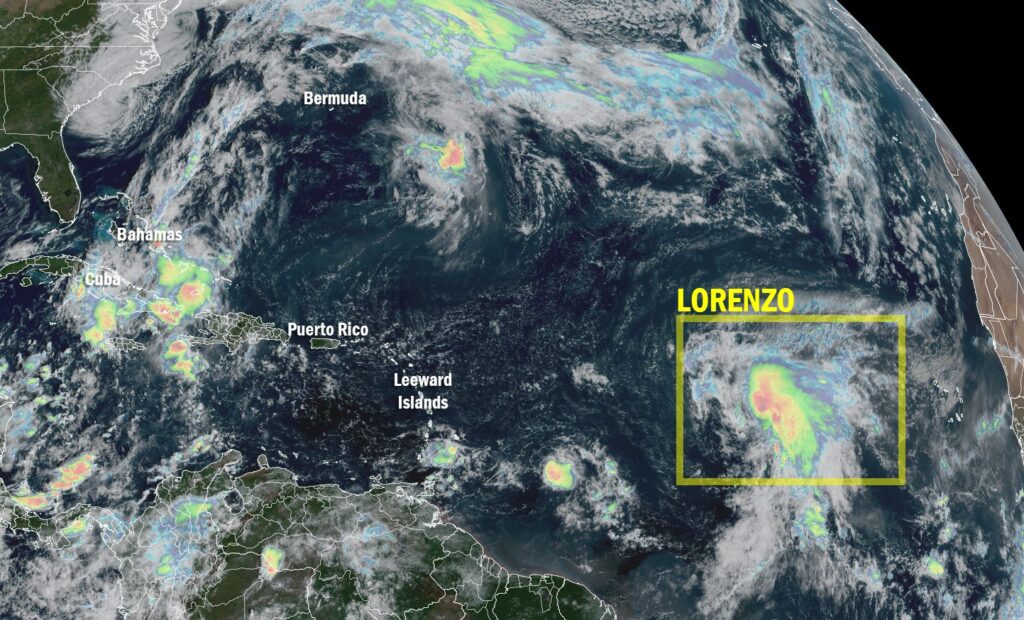
Tropical Storm Lorenzo, the 12th named storm of the 2025 Atlantic hurricane season, formed on Monday over the open waters of the Atlantic Ocean, according to the U.S. National Hurricane Center (NHC). The system currently poses no immediate threat to any land areas.
Storm Path and Forecast
As of the latest advisory, Lorenzo was located several hundred kilometers east of the northern Leeward Islands, moving north to northeast at about 18 km/h (11 mph). The storm’s maximum sustained winds are around 65 km/h (40 mph), with forecasters predicting possible gradual strengthening over the next 24 hours as it moves across warmer waters.
Forecast models indicate that Lorenzo will remain over the open Atlantic Ocean and is expected to transition into a post-tropical cyclone later in the week due to cooler sea temperatures and stronger wind shear.
“Lorenzo is expected to stay far from any landmass,” the NHC stated. “We don’t anticipate any coastal warnings or watches at this time.”
Season Overview
The 2025 Atlantic hurricane season has been notably active, featuring storms such as Hurricane Iris and Tropical Storm Javier, both of which brought localized flooding and temporary power outages to affected regions. Meteorologists attribute the high activity to above-average sea surface temperatures and favorable atmospheric conditions that promote storm formation.
Monitoring Continues
While Lorenzo remains a distant system, both the NHC and the National Oceanic and Atmospheric Administration (NOAA) continue to track its progress for any potential changes in direction or intensity. Maritime operators and shipping routes across the North Atlantic have been advised to monitor forecasts closely.
Experts remind residents across the Atlantic basin that the hurricane season, which runs from June 1 through November 30, is still ongoing — and preparedness remains crucial, even when current systems stay offshore.
For now, Tropical Storm Lorenzo remains a remote but closely monitored storm, contributing to what meteorologists describe as one of the most active mid-October stretches in recent Atlantic hurricane history.

