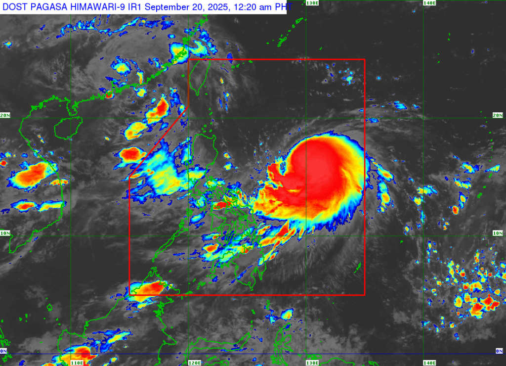
Severe Tropical Storm Nando has intensified into a typhoon early this morning, the Philippine Atmospheric, Geophysical and Astronomical Services Administration (PAGASA) confirmed. Authorities are closely monitoring its development and tracking its projected path.
Warnings for Residents
PAGASA is urging residents in potentially affected areas to remain vigilant and follow official advisories. The agency highlights that typhoons can bring:
- Strong winds capable of causing structural damage.
- Heavy rainfall leading to flooding in low-lying and coastal areas.
- Landslides, storm surges, and possible disruption of transportation and utilities.
Communities are advised to secure property, prepare emergency kits, and avoid unnecessary travel until the storm passes.
Disaster Preparedness Measures
Local government units (LGUs) have been instructed to activate disaster response plans and ensure evacuation centers are ready for high-risk residents. Depending on the storm’s impact, schools, offices, and public transport services may be suspended.
Official Updates Recommended
PAGASA will continue issuing regular updates on Nando’s strength, trajectory, and safety measures. Citizens are strongly encouraged to rely on official channels for accurate information and avoid rumors circulating on social media.
Safety Precautions
Experts stress that adhering to warnings can significantly reduce casualties and property damage. Residents should:
- Stay indoors during peak storm activity.
- Avoid crossing flooded roads or rivers.
- Keep emergency supplies and communication devices handy.
As Typhoon Nando gathers strength over warm ocean waters, the Philippines braces for potentially severe weather. Authorities reiterate the importance of vigilance, preparedness, and prioritizing safety in the coming hours.

